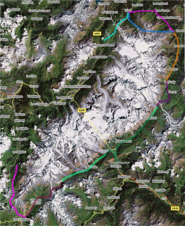
 In July 2006, we went on a walking tour round Mont Blanc organised by the French company Cairn, which specialises in mule-accompanied guided walks. The complete Tour de Mont Blanc takes about 10 days. The Cairn trip takes 7 days to do about 3/4 of it. It starts from Notre Dame de la Gorge and ends at Le Tour. The map below shows each day's route with a line of a different colour - put your mouse over each of these lines to see the start and finish for each day and click to see photos and a description of that day. As you can see from the map, the walk left out the Chamonix Valley and skips a little bit near Courmayeur where we took a bus. For a study of the route and its callenges and points of interest, we recommend the book 'Tour of Mont Blanc' by Kev Reynolds, published by Cicerone.
This Google maps composite image shows the whole Mont-Blanc massif and the national borders of France Italy and Switzerland meeting at the summit of Mont Dolent, one of the peaks in the massif. The greyish track-like objects are all glaciers.
Roll your mouse over the coloured line to see each day's route and click to get a page of photos and details about that day.